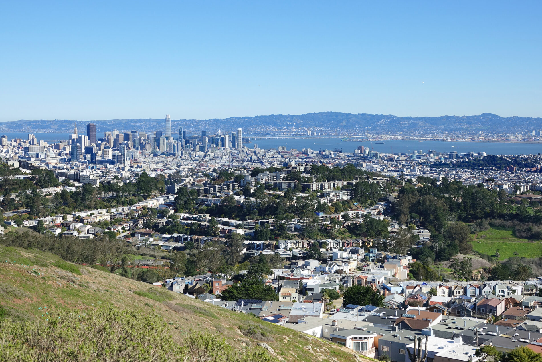
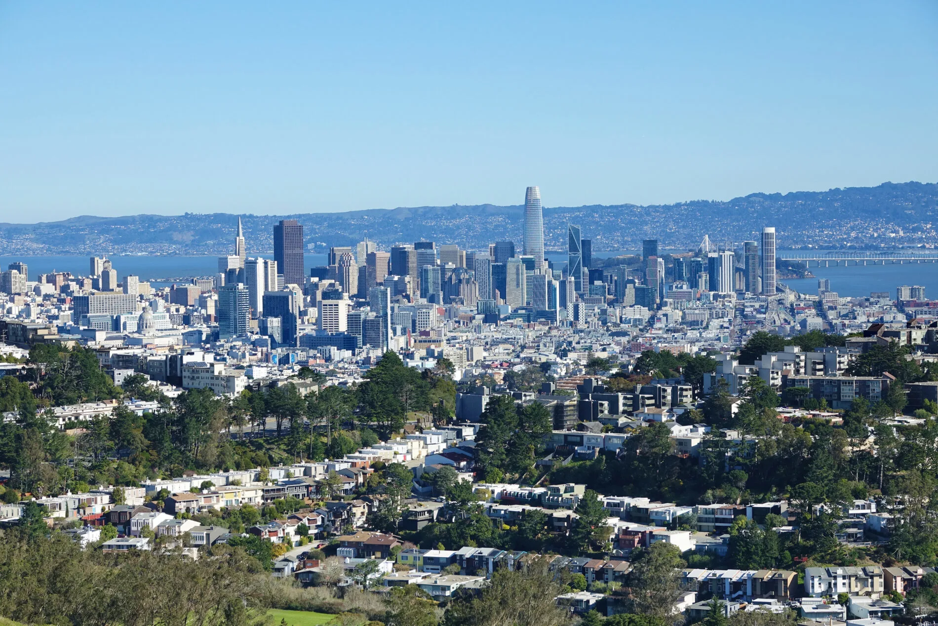
Do you enjoy hikes with scenic woods and hilltops with amazing views? If so, trek up Mt. Davidson for gorgeous views of the San Francisco skyline and bay.
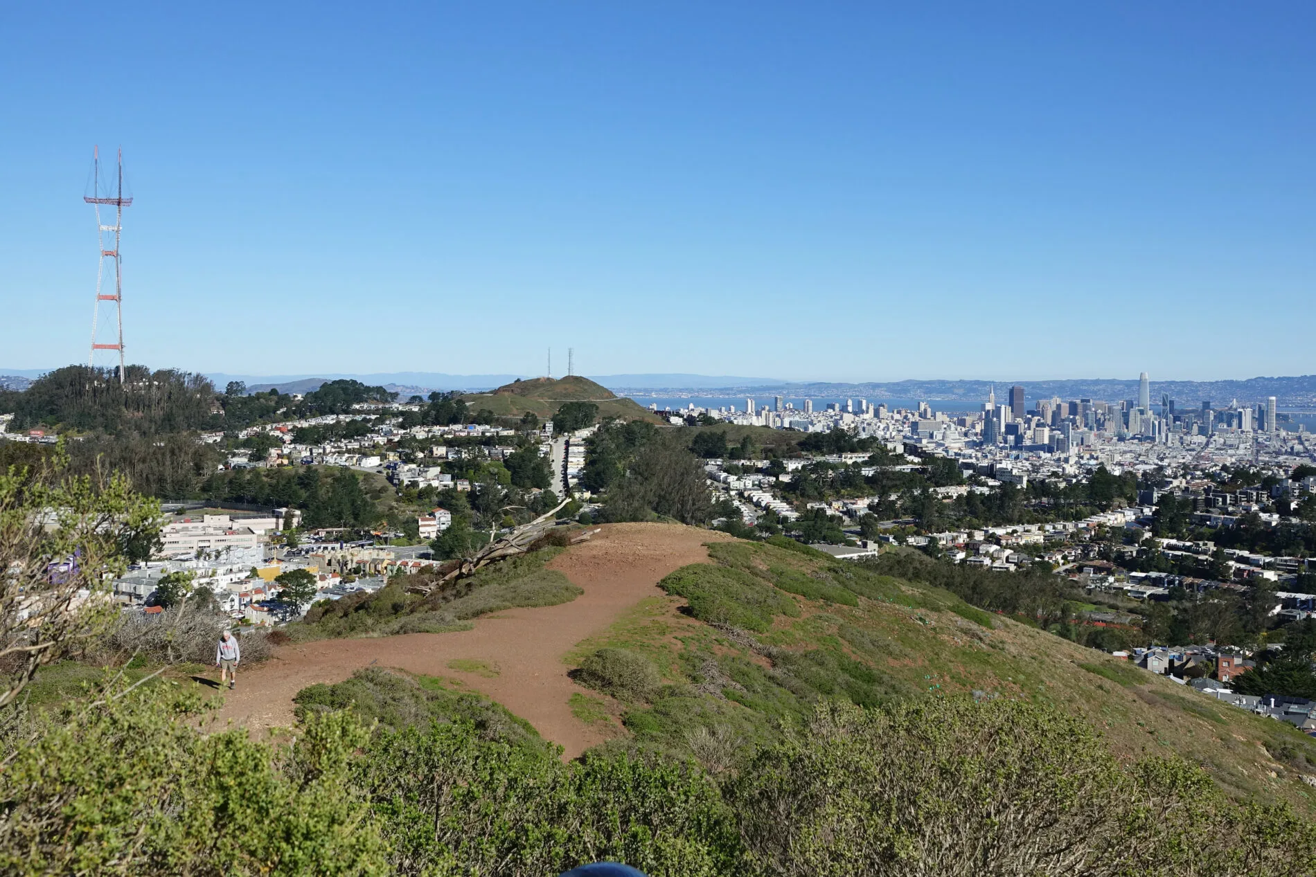
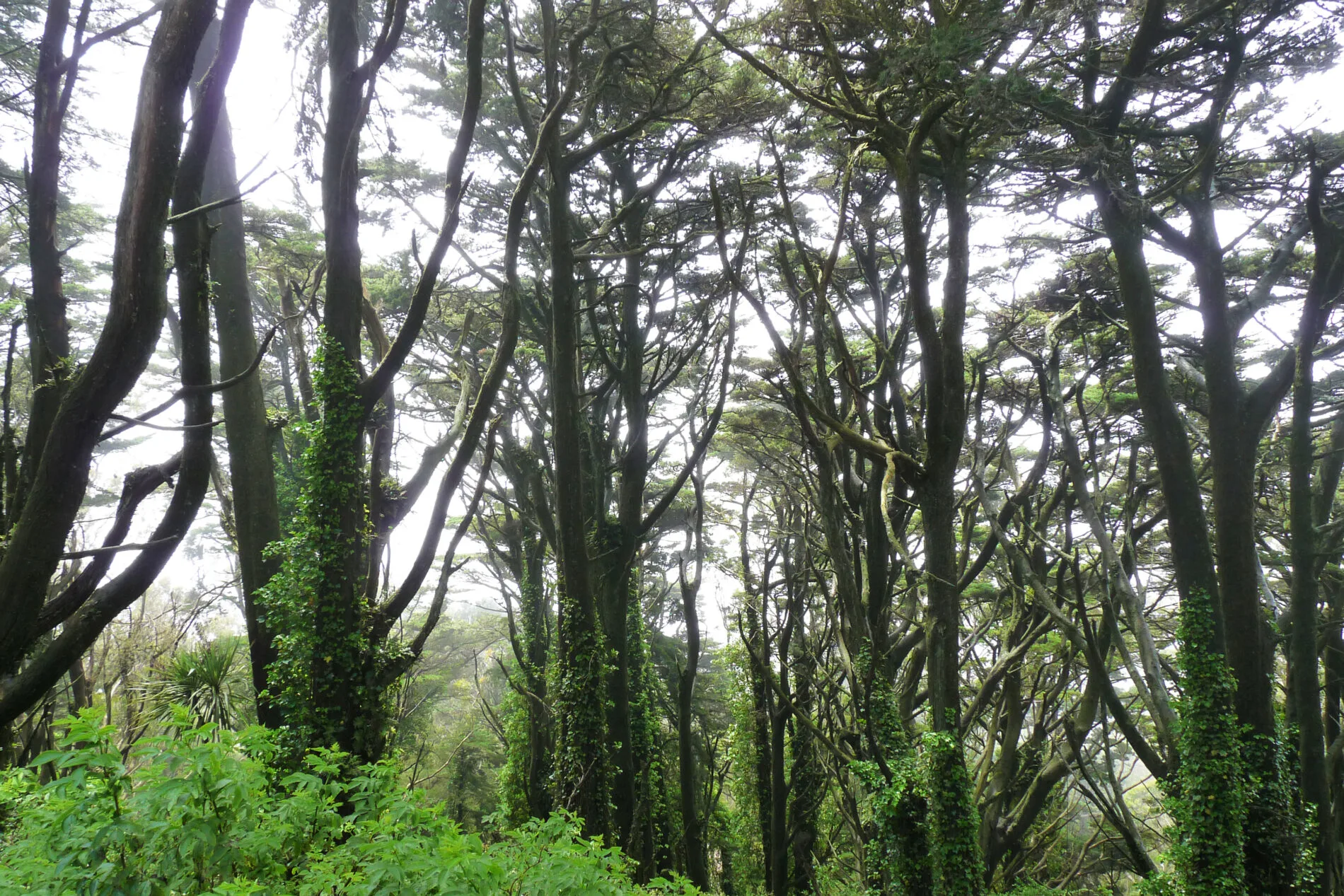
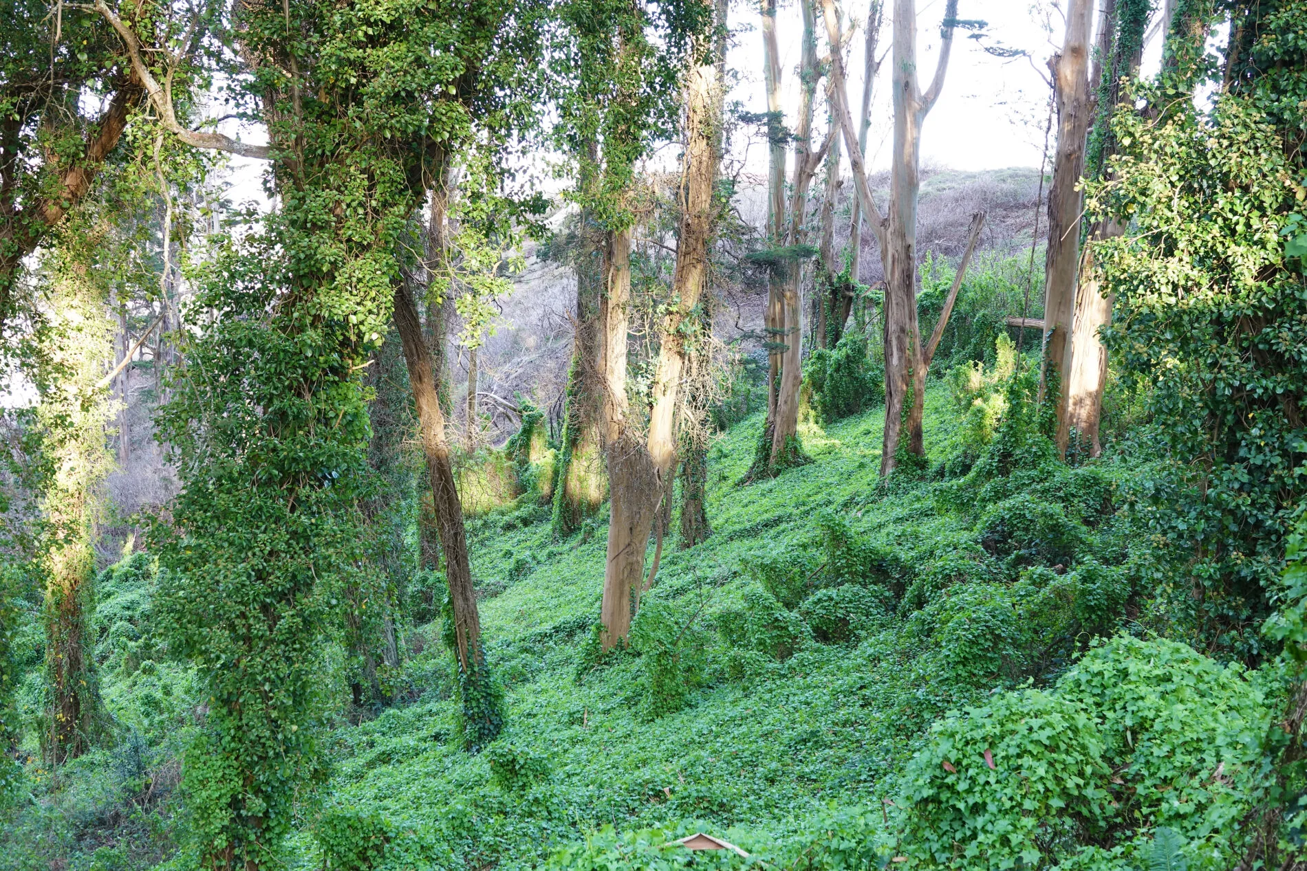
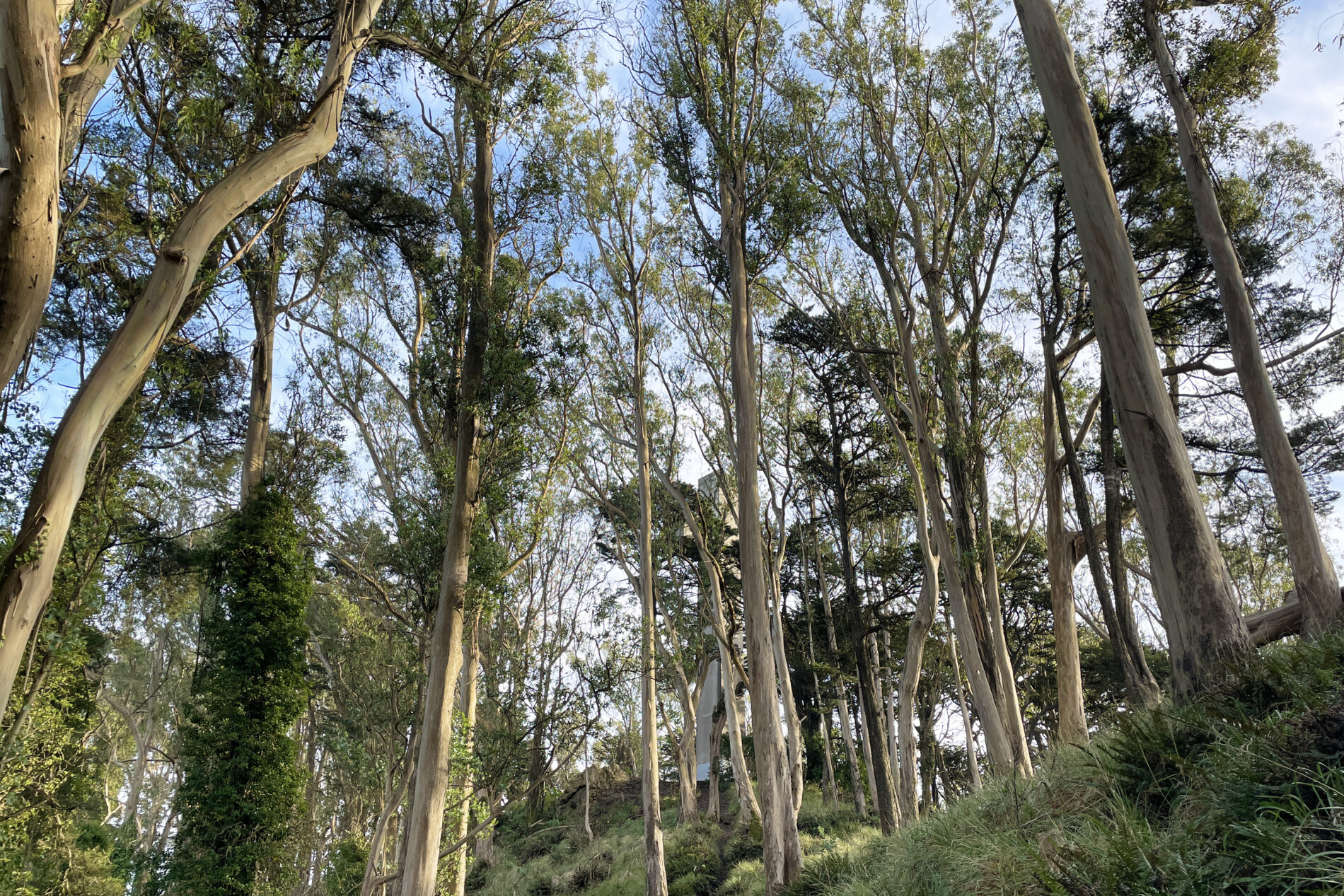
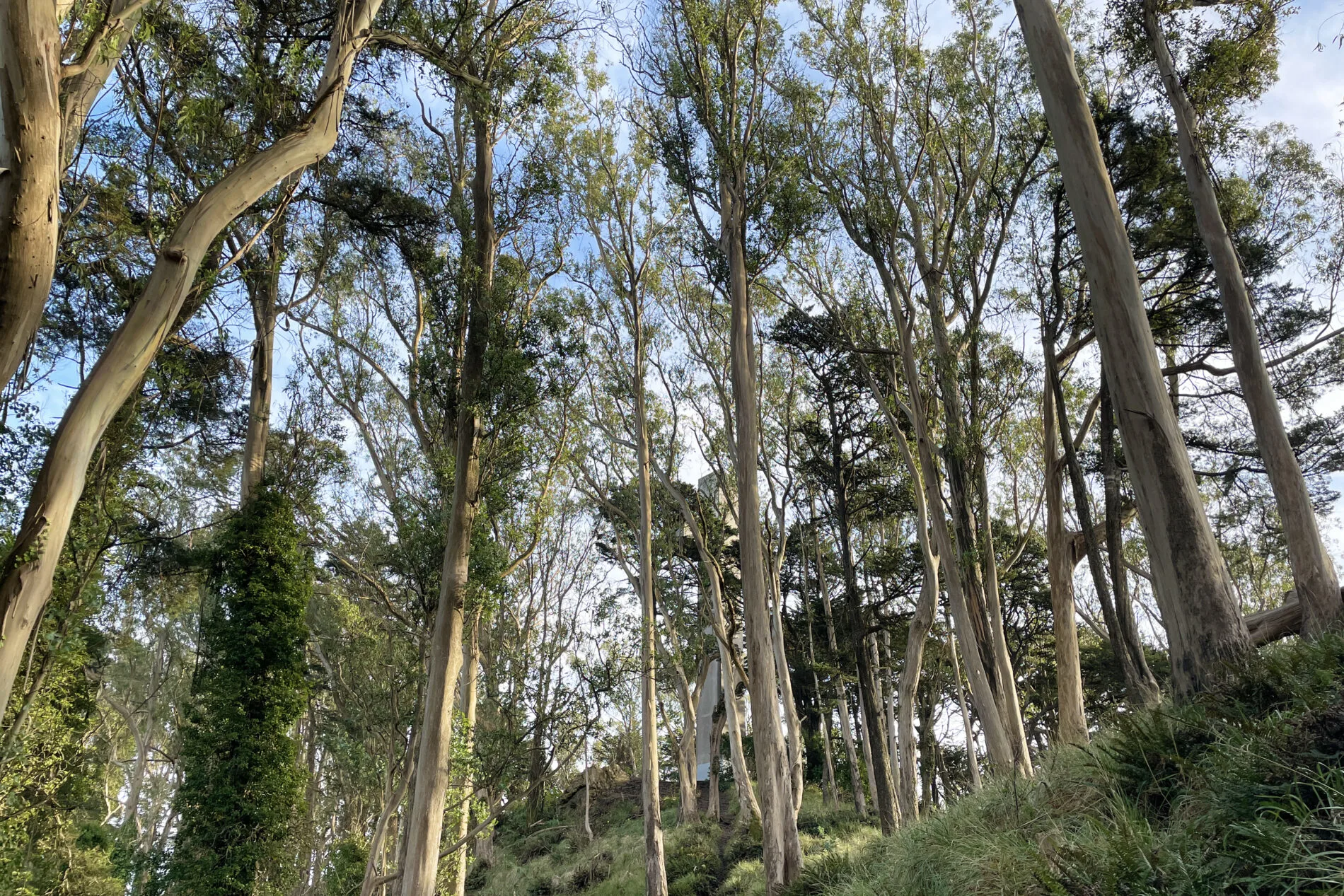
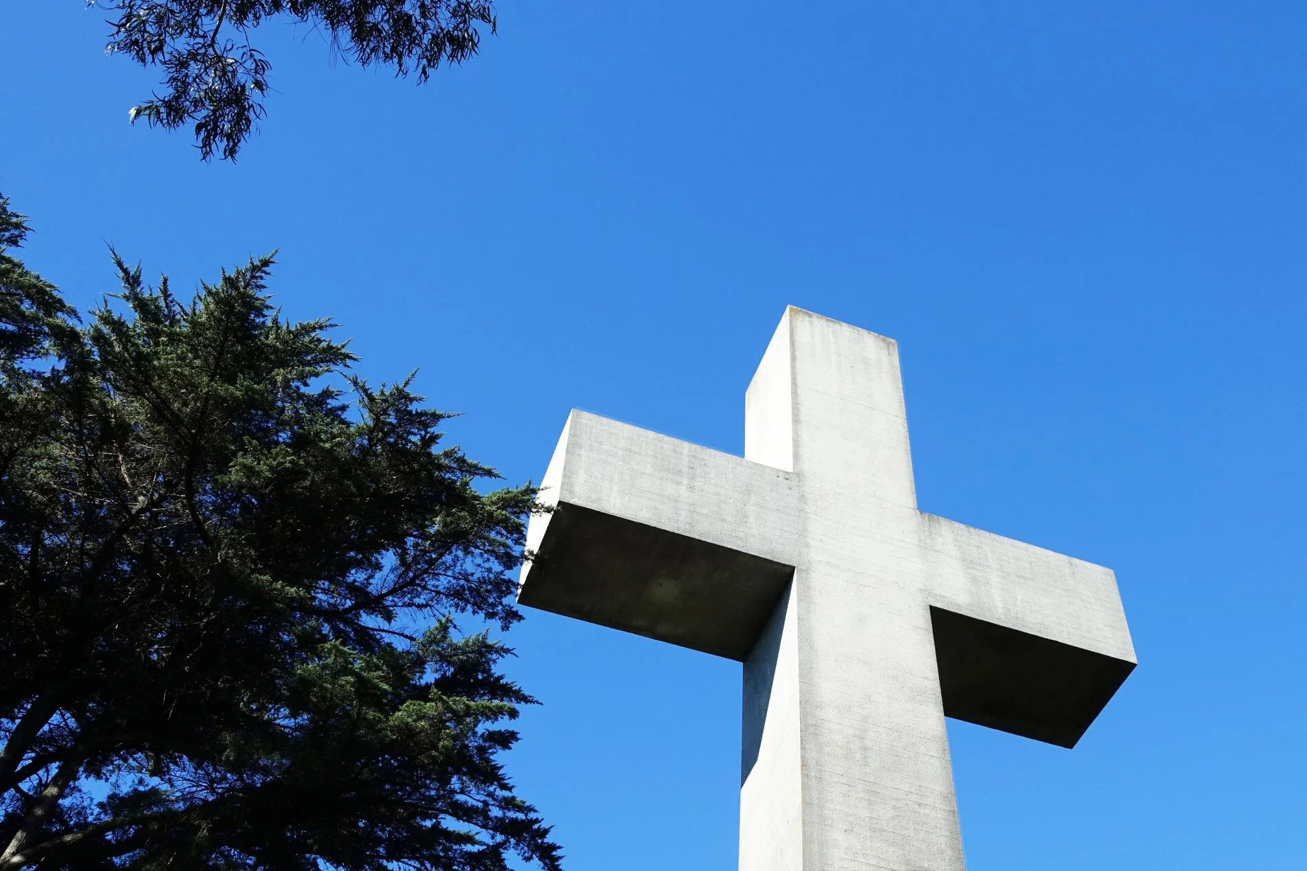
At 938-feet (286 m), Mt. Davidson is the highest natural point in San Francisco. For some of us, that’s reason enough to hike to the top, but there’s more. The trails wander uphill through really pleasant cypress and eucalyptus wooded areas, and at the top you’re treated to sweeping views of the city and bay. There’s also a 103-foot (31.4 m) historic cross at the top with an interesting and controversial history.
Mt. Davidson is near the center of the city, and its lower slopes are covered on all sides by residential neighborhoods. The top 40 acres are a city park and are open to the public. San Francisco has several popular trails and Mt. Davidson is one of my favorites.
In this post you’ll find:
- Location and other details about two Mt. Davidson trails: the Dalewood/Myra Trail on the southside and the Juanita Trail on the westside
- The trails at a glance (distance, difficulty, rules, amenities)
- Link to a Google map with trails plotted and places and bus stops pinned
- More about the two trails
- Best time to visit Mt. Davidson
- Getting to and from the trails: Parking, & Public Transit
- Mt. Davidson Cross history

Mount Davidson Hiking Trails
There are multiple trails on Mt. Davidson, and I’m covering two of them. Why? Because there are Muni bus stops at or near the beginning of these two trails, and I can hike up one trail and down the other. One trail is quite short and is the one most frequently taken; the other trail is much longer and zigzags through peaceful wooded areas.
Of course, you can take the same trail up and back and most people do exactly that. They walk up the short Dalewood/Myra trail, see the views and cross, and then walk back down the same trail. The two-trail advantage is that you see more of the tranquil woods and get more exercise.
Mt. Davidson Trails at a Glance
| Dalewood/Myra Trail (1-way) | 760 feet |
| Juanita Trail (1-way) | 3500 feet |
| Both trails (bus to bus) | Nearly 1 mile |
| Difficulty | Easy |
| Accessible | No |
| Kids | Yes |
| Dogs (leased) | Yes |
| Bikes | No |
| Food, water | No |
| Restrooms | No |

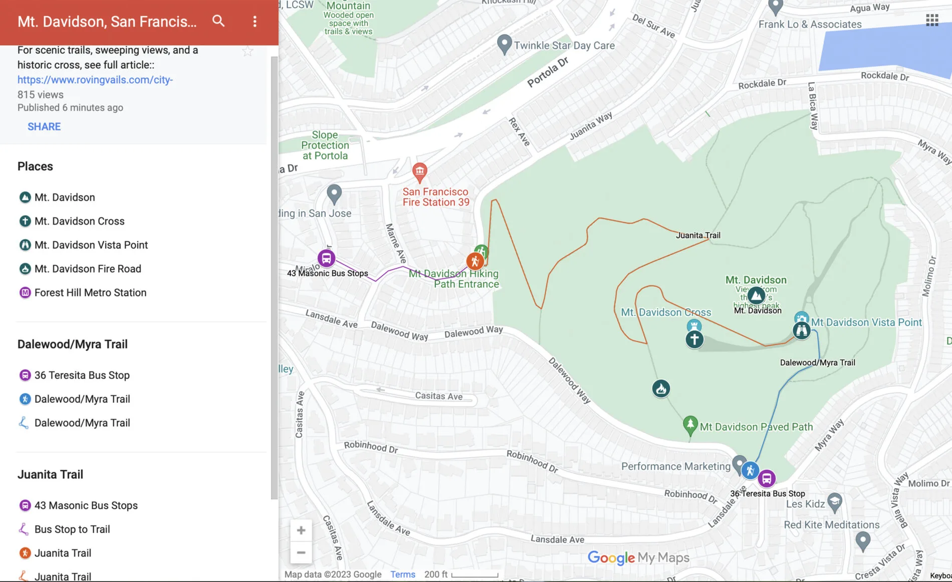
Mt. Davidson Map
The Google map linked below shows multiple trails on Mt. Davidson. The two trails covered in this post are plotted on the map and pins mark the bus stops and places of interest:


About the Two Trails
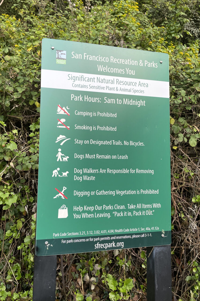
Both trails lead to the top of Mt. Davidson and end between the cross and a vista point with gorgeous views overlooking the city. Both trails pass through peaceful, wooded areas and both have generic San Francisco Recreation and Parks signs (with the park rules) near their entrance.
Neither trail has any signage identifying the location as Mt. Davidson Park or any information about the trails. There’s a bench at the top; otherwise, there are no amenities: no restrooms, food, or water.
Bench story: On my most recent trek up Mt. Davidson, I shared the only bench with a man who had a jumble of equipment with him. He said he’s a ham radio operator, and he walks to the top of Mt. Davidson a couple of times a week because it has the strongest signal in the area. He said he can talk to people all over the world.


Dalewood/Myra Way Trail
This trail is on the south side of Mt. Davidson and is located where Dalewood Way, Myra Way, and Lansdale Avenue come together. It’s conveniently located next to a 36 Teresita Muni bus stop. This is the shortest and most direct route to the top. It’s only about 760-feet (244m), but it’s a bit steeper and less scenic than the Juanita Trail.


Juanita Trail
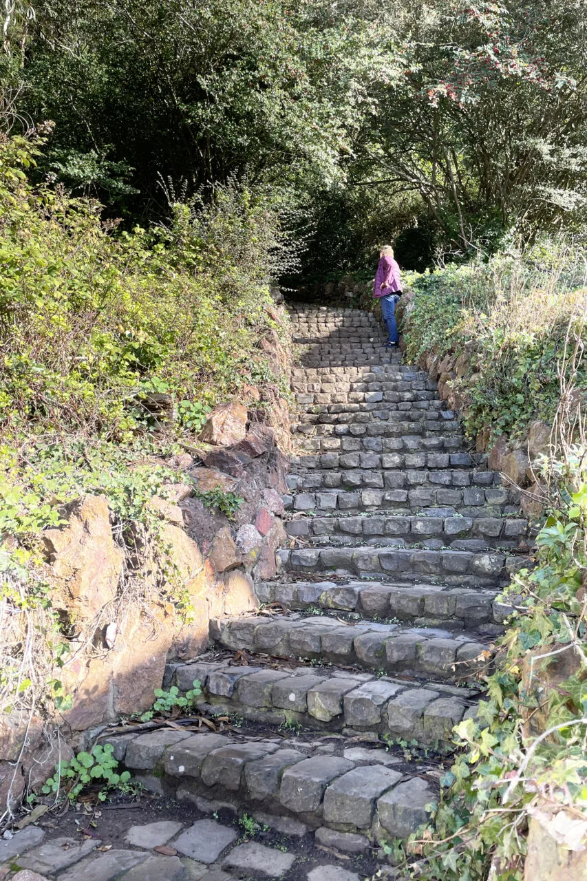
This trail is on the west side of Mt. Davidson. It’s about 3500-feet (1,067 m) to the top and zigzags through some really pleasant wooded areas. The entrance begins at 298 Juanita Way. A flight of old stone steps is the only clue you’ve found the trail. The distance from the 43 Masonic Muni bus stop (at Miraloma and Juanita) to the stone steps is about 700 feet (213 m).
Tip: Look closely at the Juanita Trail plotted on the Google map and you’ll see forks in the trail. There’s no signage telling you which way to go, so follow the map. I recently walked down the Juanita Trail and went left instead of right at the fork near the bottom of the trail and came out on Dalewood Way instead of Juanita. It was a mistake, but not a problem. I just had to walk a couple of blocks down Dalewood to get to Juanita and the 43 Masonic bus stop.

Best Time to Visit Mt. Davidson
The Mt. Davidson trails beg to be taken at least twice because the weather conditions make a difference. The sweeping views of the city and bay are best on a totally clear day, but the wooded areas can be amazing on a foggy day when the sun starts to burn through and soft filtered light brightens the foliage. Here are the pros and cons of different weather conditions:
- Sunny: San Francisco is notorious for having beautiful, sunny, 60-70° (16-21°c) days scattered throughout the year, but the most predictably good weather is in the fall from mid-September through mid-November.
- Clear: A clear day with great views is harder to plan. It happens more during cold winter weather and often following a storm.
- Foggy: San Francisco gets lots of fog, especially in the summer months. Fog is not ideal for views of the city skyline and bay, but it’s really great when filtered sunlight shines through the wisps of mist surrounding the trees.
- Rainy: The rainy season is mostly from November through March. Rain often clears the air and makes the views better, but the Mt. Davidson trails are mostly dirt with scattered leaves and rocks; they can be muddy and slippery.

Getting There: Parking, & Public Transit
Mount Davidson is in the middle of San Francisco. Refer back to the Google map above for its exact location. The trails and bus stops are plotted and pinned on the map.
Parking: Only on the street but not restricted.
Public Transit: Both of the buses that stop at (or near) a Mt. Davidson Trail also stop at the Forest Hill Metro Station. So an easy way to get to them is to take either a K Ingleside or M Ocean View Muni Metro Line to the Forest Hill Station and catch a bus from there. Here are the two buses you can catch at the Forest Hill Metro Station and take to/from a trail:
- Bus to the Dalewood/Myra Way Trail: take a 36 Teresita bus (toward Chavez & Valencia) and get off at the Dalewood/Myra Way stop. The trail is next to the bus stop.
- Bus to the Juanita Trail: take a 43 Masonic bus (toward Munich & Geneva) and get off at the corner of Miraloma and Juanita Way. Then walk about 700 feet on Juanita Way to the trail entrance. The trail begins with a flight of old stone steps.
If you’re not familiar with San Francisco’s public transit system, you’ll likely need more general information like fares, ways to pay, apps, and maps. We have those details covered in getting around on public transit.
About Mt. Davidson Park
This park is managed by the San Francisco Recreation and Parks Department. Their webpage is really brief, but it does provide information about Mt. Davidson’s flora and fauna.
Mt. Davidson is named after George Davidson who was a prominent geographer and engineer and led several important projects and expeditions. Among his many accomplishments, he was Chief of the U.S. Coast and Geodetic Survey’s Pacific Operations, a professor at UC Berkeley, and a charter member of the Sierra Club. (Source)
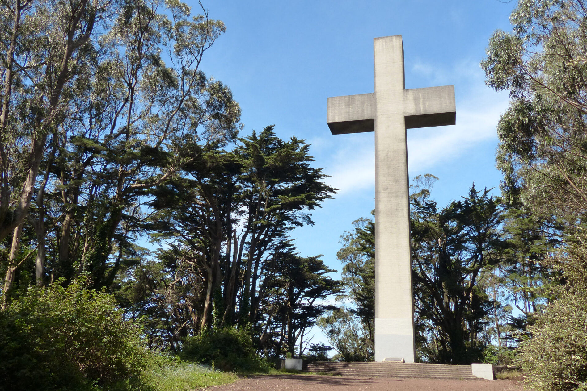

Mt. Davidson Cross: History, Controversy, Resolution
Easter sunrise services have been held on Mt. Davidson since the 1920s. In 1934, the WPA built the striking 103-foot (31.4 m) concrete cross that is there now. Of course, having a cross on public land became controversial. Some citizens wanted the cross to remain, some wanted it removed, and the ACLU filed a lawsuit against the city.
It was a very tough and emotional issue for the citizens of San Francisco. Finding a solution wasn’t easy, but San Francisco’s voters solved the dilemma in 1997 by passing Proposition F. It allowed the city to hold an auction and sell the top of Mt. Davidson Park to a private organization. This put the cross on private land and eliminated the separation of church and state issue.
The Council of Armenian American Organizations of Northern California won the auction and purchased the top 0.38-acres of the 40-acre park. The Armenian Council is now the steward of the top of Mt. Davidson, and they maintain and preserve it. Easter sunrise services are held there, as they have been since the 1920s.

The cross is also now a memorial to the 1915 Armenian Genocide. The Armenian Council members describe their role as guardians of the cross. They state that the cross belongs to the people of San Francisco and stands as a memorial to “all victims of genocide and human rights abuses.”
To learn more about the history of the cross, watch the following 15-minute video produced by the Council of Armenian American Organizations of Northern California:
Conclusion
Mt. Davidson is one of my favorite San Francisco hikes. The 40-acre park is laced with trails that include peaceful walks through wooded areas and beautiful views of the surrounding city. Fresh air and exercise are always a bonus. I also like that the Muni bus system makes it easy to hike up one trail and down another.
Our Hiking in San Francisco post has brief details about our favorite hikes. We also have separate posts for each hike with a map, photos, and more detailed information:
- Lands End Trail: Ocean Views
- Golden Gate Promenade: Waterfront Trail, Best Views
- Barbary Coast Trail: Self-Guided Walking Tour
- Mountain Lake Trail: Presidio Hike
- Golden Gate Park: Trek from End-to-End
- Gorgeous Mosaic Tiled Stairs and Grandview Park Views
About the Author
Ginny Vail is a travel writer who loves travel planning, sightseeing, photography, and videography. She’s visited all 50 states and traveled around the world. Her articles focus on discovering places to go, sights to see, and details about when and how to visit them.